Attēls:Russian Turkestan map 1900.jpg
No ''Vēsture''
Šī priekšskata izmērs: 800 × 595 pikseļi. Citi izmēri: 320 × 238 pikseļi | 1 717 × 1 276 pikseļi.
Sākotnējais fails (1 717 × 1 276 pikseļi, faila izmērs: 2,74 MB, MIME tips: image/jpeg)
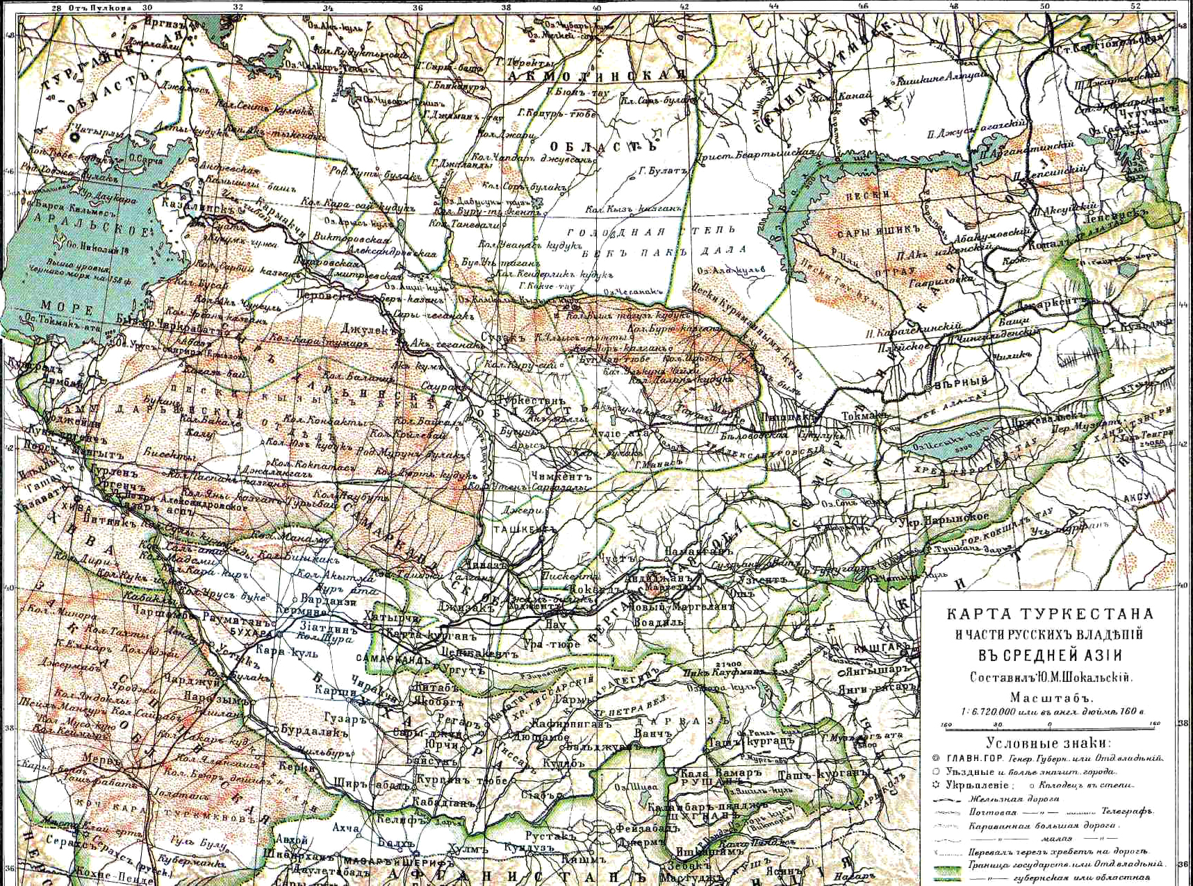
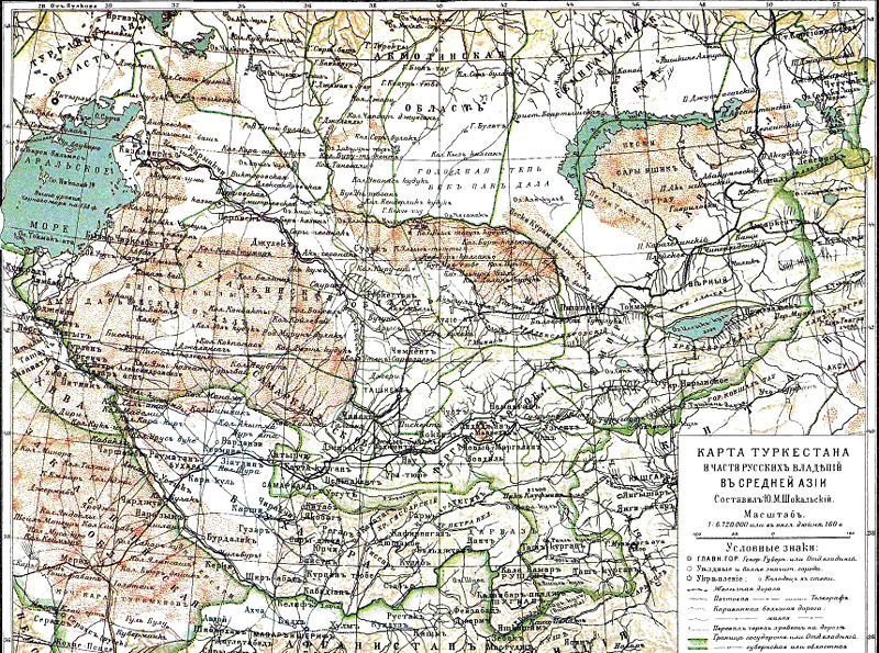
The map of Russian Turkestan and Khanates of Khiva and Bukhara, from Brockhaus and Efron Encyclopedic Dictionary (1890-1907). The area shown on the map includes the entire territory of today's Tajikistan and Kyrgyzstan, almost all of Uzbekistan, eastern part of Turkmenistan, and south-eastern Kazakhstan.
Faila hronoloģija
Uzklikšķini uz datums/laiks kolonnā esošās saites, lai apskatītos, kā šis fails izskatījās tad.
| Datums/Laiks | Attēls | Izmēri | Dalībnieks | Komentārs | |
|---|---|---|---|---|---|
| tagadējais | 2008. gada 9. decembris, plkst. 13.02 | | 1 717 × 1 276 (2,74 MB) | Buks Artis (Diskusija | devums) | The map of Russian Turkestan and Khanates of Khiva and Bukhara, from Brockhaus and Efron Encyclopedic Dictionary (1890-1907). The area shown on the map includes the entire territory of today's Tajikistan and Kyrgyzstan, almost all of Uzbekistan, eastern p |
- Šo failu nevar pārrakstīt.
Faila lietojums
Šajā lapā ir saite uz šo failu: