Atšķirības starp "Attēls:Roma provinces.jpg" versijām
No ''Vēsture''
(Romas impērijas Eiropas provinces. Gaul in the Time of Caesar. The Rhine Country in Roman Times. Country about the Lower Danube in Roman Times. From The Historical Atlas by William R. Shepherd, 1911. Kategorija:Eiropas kartes) |
(Nav atšķirību)
|
Pašreizējā versija, 2008. gada 27. novembris, plkst. 08.40
Romas impērijas Eiropas provinces. Gaul in the Time of Caesar. The Rhine Country in Roman Times. Country about the Lower Danube in Roman Times. From The Historical Atlas by William R. Shepherd, 1911.
Faila hronoloģija
Uzklikšķini uz datums/laiks kolonnā esošās saites, lai apskatītos, kā šis fails izskatījās tad.
| Datums/Laiks | Attēls | Izmēri | Dalībnieks | Komentārs | |
|---|---|---|---|---|---|
| tagadējais | 2008. gada 27. novembris, plkst. 08.40 | 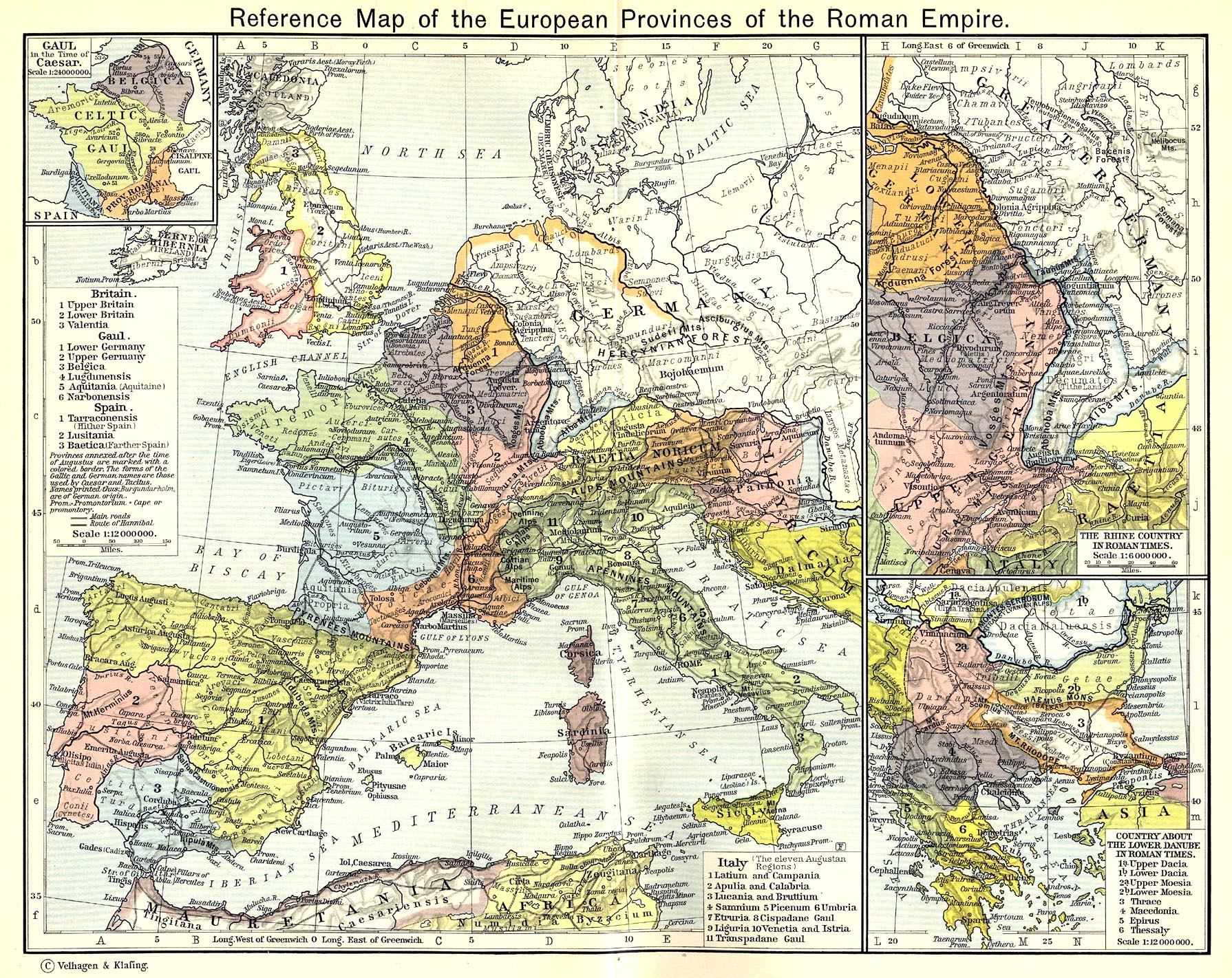 | 1 790 × 1 422 (900 KB) | Buks Artis (Diskusija | devums) | Romas impērijas Eiropas provinces. Gaul in the Time of Caesar. The Rhine Country in Roman Times. Country about the Lower Danube in Roman Times. From The Historical Atlas by William R. Shepherd, 1911. Kategorija:Eiropas kartes |
- Šo failu nevar pārrakstīt.
Faila lietojums
Šajā lapā ir saite uz šo failu: