Atšķirības starp "Attēls:Palestine 1020 BC.jpg" versijām
No ''Vēsture''
m |
m |
||
| 1. rindiņa: | 1. rindiņa: | ||
"Palestine in the time of Saul." From Atlas of the Historical Geography of the Holy Land. Smith, George Adam. London, 1915. | "Palestine in the time of Saul." From Atlas of the Historical Geography of the Holy Land. Smith, George Adam. London, 1915. | ||
| − | [[Kategorija: | + | [[Kategorija:Palestīnas kartes]] |
Pašreizējā versija, 2008. gada 3. decembris, plkst. 12.48
"Palestine in the time of Saul." From Atlas of the Historical Geography of the Holy Land. Smith, George Adam. London, 1915.
Faila hronoloģija
Uzklikšķini uz datums/laiks kolonnā esošās saites, lai apskatītos, kā šis fails izskatījās tad.
| Datums/Laiks | Attēls | Izmēri | Dalībnieks | Komentārs | |
|---|---|---|---|---|---|
| tagadējais | 2008. gada 25. novembris, plkst. 22.52 | 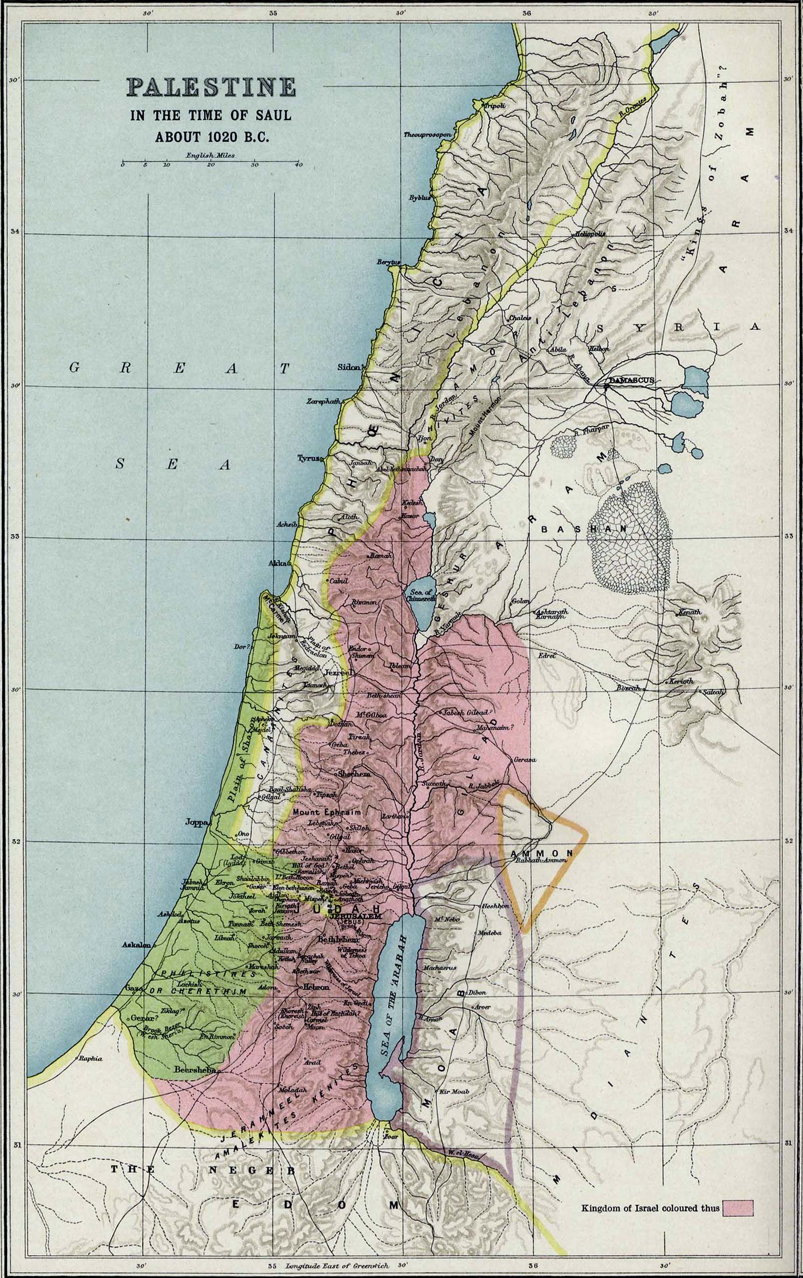 | 1 620 × 2 577 (642 KB) | Buks Artis (Diskusija | devums) | Palestīna ap 1000. g.p.m.ē. Kategorija:Tuvo Austrumu kartes |
- Šo failu nevar pārrakstīt.
Faila lietojums
Šajā lapā ir saite uz šo failu: